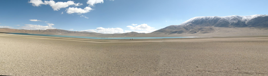
My best attempt at a photo stitch of Baqan Tso, Tibet. The lake surface does not normally bend up in different directions.
|
The Asian Monsoon provides water resources to much of Asia and there is therefore intense interest in how future warming will affect regional water sources. Paleoclimate evidence suggests that even within the Holocene (<12 ka) there were significant changes in water availability on the continent that are important to understand. To better understand the timing and magnitude, as well as the spatial extent, of this variability, my colleagues and I investigated lake and wetland deposits on the Tibetan Plateau. |
|
We used two complementary lake systems, Ngangla Ring Tso and Baqan Tso, to understand water availability. Both lakes are closed-basin lakes, meaning that water only leaves the system through evaporation. This make lake-level much more sensitive to variations in, for example, relative humidity, wind speed, and precipitation amount, than an open-basin lake. When closed-basin lakes are in (near) steady state, where incoming and evaporating water are in equilibrium, the lake can develop prominent shoreline deposits. These deposits may persist through geologic time and leave “bathtub rings” that show how high lake level was in the past. |
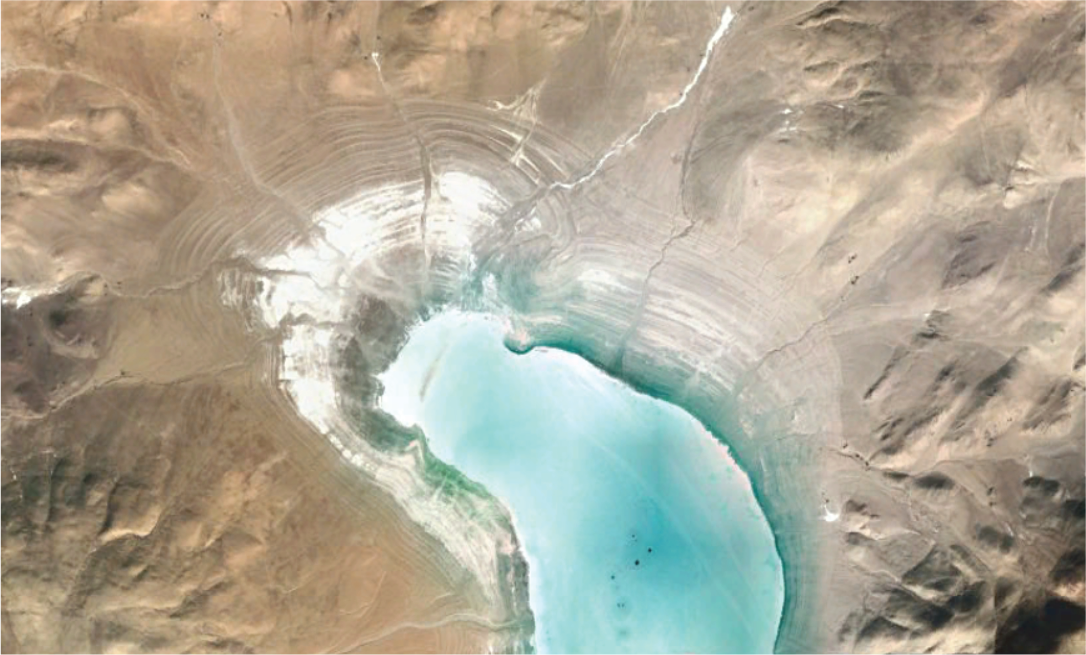
"Bathtub rings" mark former shorelines at Baqan Tso in Tibet. Picture is from Google Earth Pro.
|
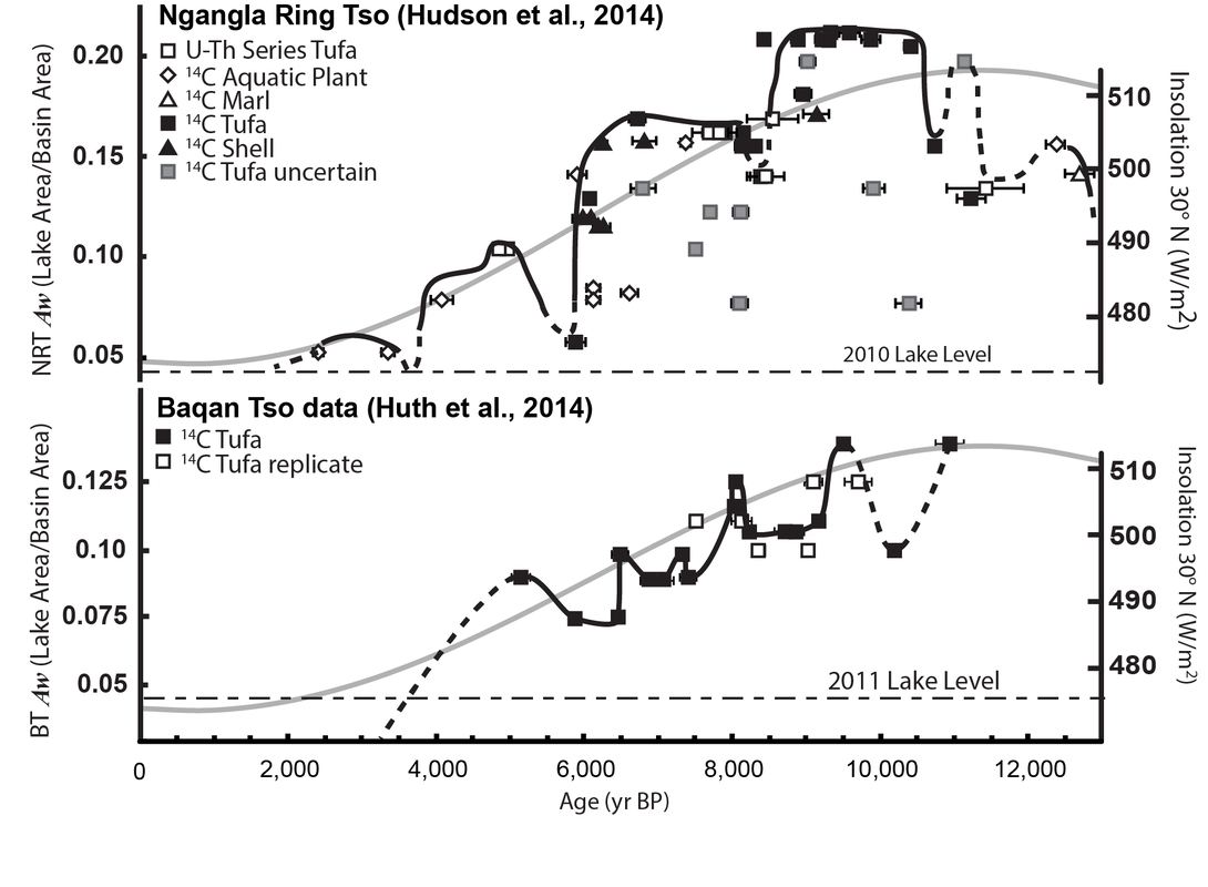
Reconstructed lake levels from Ngangla Ring Tso (top) and Baqan Tso (bottom) through time (after Hudson et al., 2015 and Huth et al., 2015). The lake level curves are inferred from a U-Th and 14C dates on a variety of material (see different symbols) and are dashed where we are not certain of the trend. The left y-axes show lake area normalized to the total basin area – in other words, up on the axis means a bigger lake had to be sustained (e.g., by more rainfall, higher relative humidity). The right y-axes show June insolation at the lake.
|
Ngangla Ring Tso basin has large, well-cemented shorelines that are easy to spot and sample. We dated tufa and beach cement for radiocarbon and U-Th series ages to develop a millennial-scale record of lake-level changes. The resulting data demonstrates that, in line with other regional records, the lake had a highstand in the early Holocene (~10-8 ka), coinciding with peak Northern Hemisphere summer insolation and Indian Summer Monsoon intensity. Lake level then generally declined toward the present, but there are a series of millennial-scale oscillations superimposed on this trend that are likely related to weak monsoon events. Baqan Tso is a smaller lake and the basin has less prominent relict shorelines. Even so, we were able to find useable material for dating and demonstrated that lake-levels at both sites largely varied in sync, which is reasonable given their proximity. 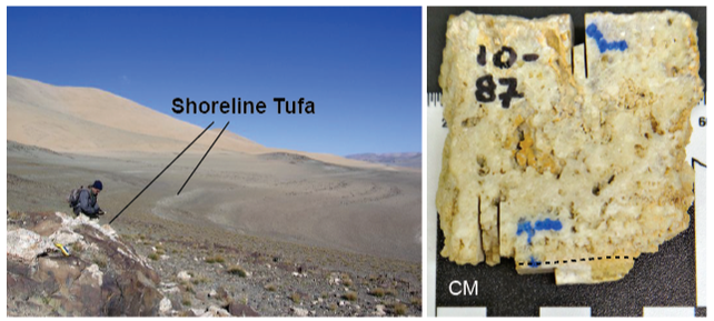
Left: thinking on an ancient shoreline
Right: close-up of a piece of tufa
(pictures from Adam Hudson; after Hudson et al., 2015)
|
|
We additionally investigated the Baqan Tso basin because it had an advantage over the Ngangla Ring Tso basin – it had no evidence of previous glaciation. This meant that changes in lake size could only be due to other climate parameters (e.g., temperature, rainfall, radiative flux, wind speed, relative humidity, albedo), which simplifies modeling. We used a coupled runoff and lake surface evaporation model to simulate the conditions required to sustain ancient lake shorelines. The results suggested that an ~50 % increase in precipitation would have been required to sustain the early Holocene lake highstand at Baqan Tso (380 mm/yr vs. 240 mm/yr modern), a substantial increase in this semi-arid region. |
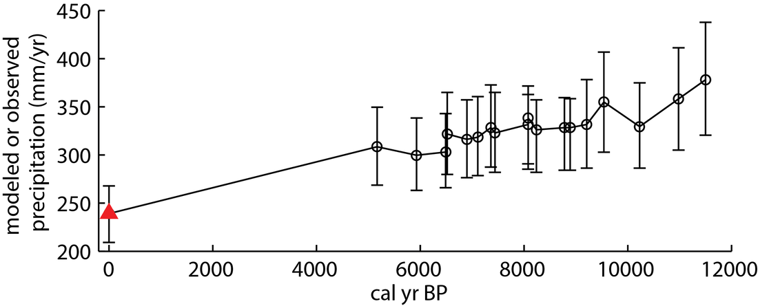
Modeled mean annual precipitation at Baqan Tso through time (after Huth et al., 2015). The red triangle shows modern precipitation for the site.
|